1
/
of
2
Out of stock
Turn of the Centuries
Turn of the Centuries - Harstine Island, Washington Topographic Bathymetric Map Print
Turn of the Centuries - Harstine Island, Washington Topographic Bathymetric Map Print
Regular price
$34.00 USD
Regular price
Sale price
$34.00 USD
Unit price
/
per
Shipping calculated at checkout.
Couldn't load pickup availability
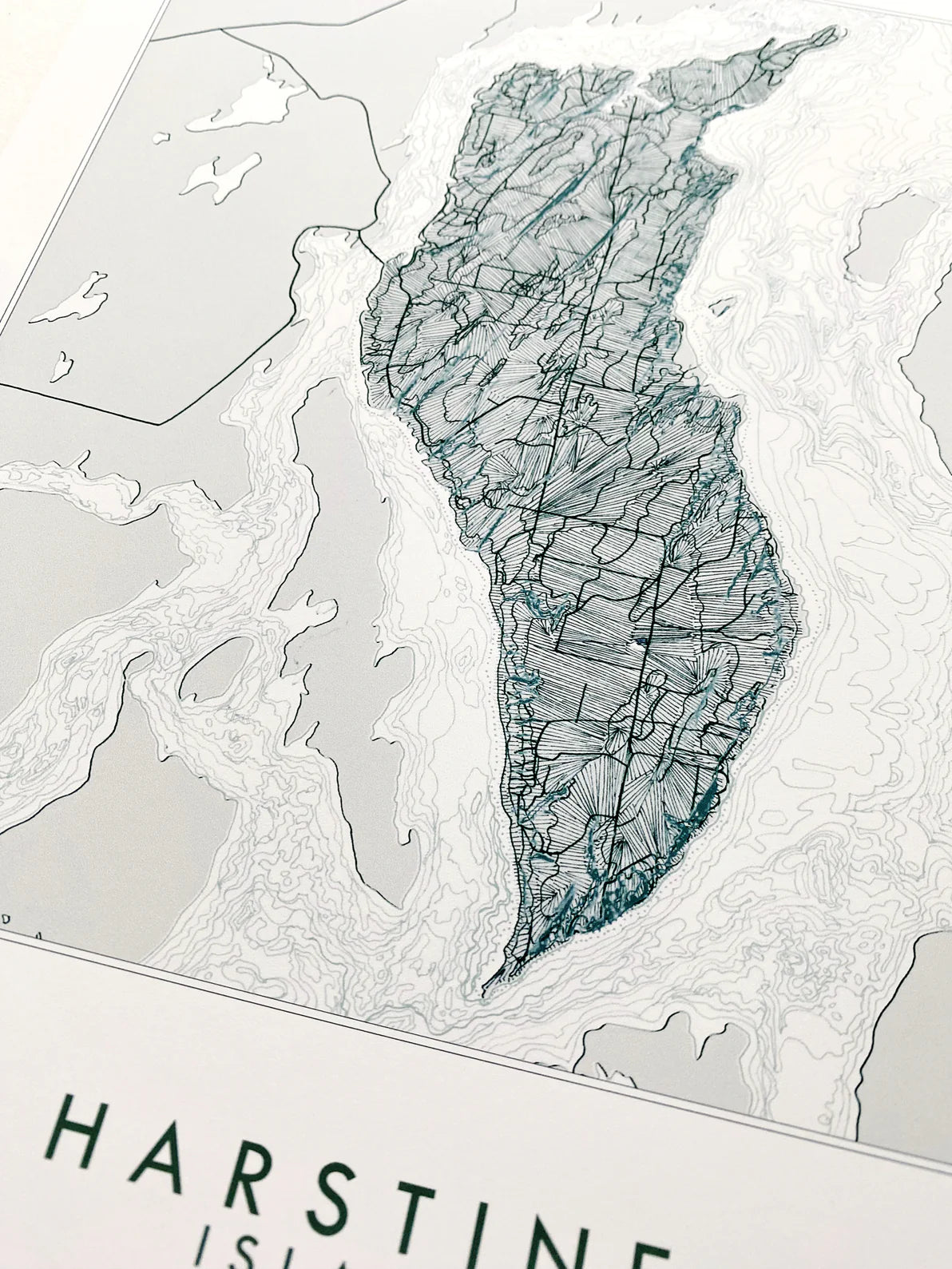
HARSTINE ISLAND, Washington Topographic Bathymetric Map Art Print.
For your Map Wall, memento of your Puget Sound adventures, family vacations, reminder of home.
Turn of the Centuries hand-drawn Harstine Map focuses on the Island, connected by bridge to the peninsula and surrounded by Case Inlet, a crooked finger of the South Sound. Squaxin Island and Hope Island to the southwest, Herron and McMicken Islands to the northeast. On Island, Jarrell Cove State Marine Park features on the northern tip and Spit.
Epson archival coated paper / Epson Professional high-quality inkjet printer / Archival inks
Share
<p>Earn%20[points_amount]%20when%20completing%20this%20purchase.</p>